This is a world class suspended sky bridge that is 410 feet long and located high up in Gunung MatCincang at 700+ m above sea level.
Although the video looked serene, the flying conditions were atrocious with really high winds and clouds constantly rolling in. This is one of those places where recovery of fallen gear would be nigh impossible!
http://www.youtube.com/watch?v=PoLTDREUF80
Showing posts with label drone. Show all posts
Showing posts with label drone. Show all posts
Wednesday, July 23, 2014
Friday, August 23, 2013
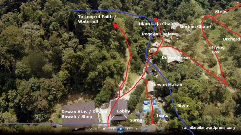
Tanah Aina, Raub
Tracked this resort at Raub. Price ranges from RM260 to RM300 per pax.
This is a plush back to nature resort and the obsessive attention to details shown by the resort owner pays dividend in giving visitors a most memorable stay. It may NOT be what a seasoned hiker would look for but for the general sedentary working populace of Malaysia - this place is full of superlatives.
This place was tracked using Montana 650. The hike to the Leap of Faith was tracked using Garmin Fenix (you are not allowed to bring anything with you for this hike save for your own personal flotation device so a wearable GPS came in very handy :) ).
Aerial shots were taken by Phantom.
Mapped to server on 9 Sep 2013.

Subscribe to:
Posts (Atom)